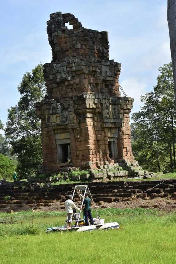
Built using a thousand elephants and 300,000 laborers, the opulent temple city of Angkor has been near-deserted for centuries, yet its grandeur and mystery now attract a million visitors each year. The question is, why was it deserted at all? An answer is finally emerging.
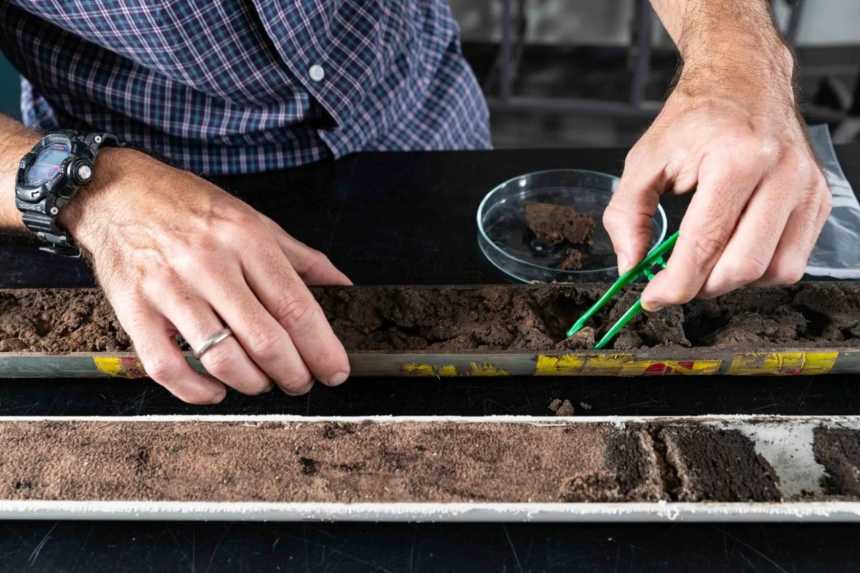
In the basement of the University’s Madsen Building are archives of Cambodia’s environmental history, including dozens of drill cores in a cool room, that were extracted from the city of Angkor. These drill cores have seen scientists reconsider the downfall of the world’s largest pre-industrial city.
Taken from just two meters beneath the earth’s surface, the cores tell the story of how land at Angkor has been used over thousands of years. “Their layers are like pages in a book,” says Associate Professor Dan Penny from the School of Geosciences.
“Once we bring a core home from Angkor and split it open, going back through each of those pages is like going back through time,” he says, his detailed descriptions conveying a deep knowledge of this ancient city, one he has explored for more than 18 years.
A wonder of the ancient world
Over five centuries, Angkor grew to cover more than a thousand square kilometers, comparable in size to modern day Los Angeles, though with a much lower population density.
The accepted view has been that Angkor collapsed suddenly in 1431, following an invasion by inhabitants of the powerful city of Ayutthaya, in modern day Thailand. Penny and his colleagues put this theory to the test when, in 2016, they took a dozen drill cores from the earth beneath Angkor’s temple moats.
From these cores Penny extracted microscopic evidence of past environmental change. In particular, he examined pollen grains from plants and charcoal derived from residential fires, while also measuring rates of erosion and sedimentation.
“We were looking for what people were doing in the landscape. How they used fire, how plants were changing, when occupation was intense and when it decreased,” he says. “We certainly didn’t find evidence of the sacking in 1431, and a sudden abandonment of the city. It was instead a very prolonged diminution in the commercial and ritual core of the city.”
Penny’s findings suggest the central city elite left Angkor gradually, attracted, perhaps, to the better located and more profitable trading centers on the Mekong Delta.

That word again: climate
Additional evidence provided by ancient tree rings suggests climatic variation may have been the nail in the coffin. Tree ring cross-sections taken from long-lived conifers indicate a major drought in Angkor towards the middle of the 14th century, followed by intense monsoons and then another big drought.
“The problem was not drought or flood, but variability between both,” Penny says. The collapse of the water network—due to a combination of intense summer monsoon rains and lack of maintenance—likely hastened the city’s desertion.
Penny began looking at Angkor as a postdoctoral researcher in 1999, and soon began collaborating with archaeologist Roland Fletcher. Now a professor, Fletcher was at Angkor exploring questions about urbanism and the demise of cities. Penny was researching environmental change at pre-Angkor sites along the Mekong Delta. Their skills were perfectly matched to explore the rise and fall of Angkor.
“It’s not a purely urban story, nor is it a purely environmental one,” says Penny. “It’s a mixture of the two.”
Penny returned from Edinburgh University to join the University of Sydney in 2001. Along with Fletcher, he is now a director of the Angkor Research Program, which brings together academics from across the University to better understand this once great city. Rather than focus on the monuments, the program delves into “the stuff that’s no longer there.”
“We’re interested in what goes on between the monuments. We’re interested in water, in forests, in soils,” all of which draws on Penny’s skills in paleo-botany and sedimentology.

Knowing the past to save the future
Why is this important? There are a number of cases, particularly in the tropics, where large, low-density cities failed at least partly because of stress generated by climate variability, Angkor among them.
“That rings quite significant alarm bells because we are moving into a century full of climate variability and more frequent climate extremes,” says Penny. “More than half of humanity lives in cities, so understanding the fundamentals of urban resilience in the context of climate change is very important.”
Penny points out that when we talk about the collapse of societies, we see it as an end point.
“But it isn’t an end point for its people,” he says. “It’s part of a transformation as populations adapt to changing environments or circumstances. In the case of the Khmer people, the decline of Angkor saw their society transform from one huge agrarian kingdom to become much smaller trading cities along the Mekong Delta.”
As Penny’s work continues on these so-called middle period cities on the Mekong Delta, his team is also exploring the collapse of civilizations in the Maya territories of Belize, Mexico and Guatemala. Happening at the end of the first millennium, the collapse of the Maya was also triggered by drought. In his Central American work, the focus is on cities that survived.
“What is it about these cities that makes them able to survive the profound changes in climate, whereas cities only tens of kilometers away were destroyed or abandoned?” he asks.
Small-picture thinking
Penny does field work in the tropics of Asia and America every year to collect drill cores. Back in Sydney, he spends much of his time in the laboratory or at the microscope set up on his desk, surrounded by slide boxes, methodically examining every sample. While this kind of scientific work takes patience, what Penny does is laced with moments of pure satisfaction, like finding a pollen grain from a crop plant that someone tended 900 years ago.
“Those connections to places and peoples that are long gone are really exciting.”


